| Ecologically
Important Areas of West Bengal Coast |  |
| | ||
|
Methodology | ||
|
Home |
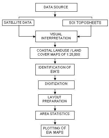
The Flow chart format is shown in the figure below:
| |
|
Home | Introduction | Objectives | Methodology | EI Areas | Info in Detail | ||
|
| Ecologically
Important Areas of West Bengal Coast | |
| | ||
|
Methodology | ||
|
Home |
The Flow chart format is shown in the figure below:
| |
|
Home | Introduction | Objectives | Methodology | EI Areas | Info in Detail | ||