Coastal
Regulation Zone of Ramanathapuram District
Geographic
Location:
This
stretch extends from Sundarapandiyapattanam at North to West of Kannirajapuram.
Geomorphologically it is located between 78º 25'E - 79º 7'30''E longitude and
9 º5'N - 9 º52' 30''N latitude.
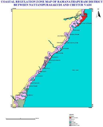
Fig:
Coastal Regulation
Zone Information in Tamil Nadu: Ramananthapuram District
Physiography:
The
northern part of the coastline stretches from Sundarapandipuram to Tondi. Salt
pans are common in this part of the coast. The sandy coastal area of Mudukulathur,
Ramanathapuram and Rameswaram, in this area the coast is fringed by sand dunes
with swamps at the back. The coastline in the stretch is generally trending towards
south from where it takes an eastward trend towards Devipattinam enclosing Palk
Strait. In the southern part of this stretch between Devipattinam and Keelakkarai,
there are raised beaches with sand bars parallel to the present coastline. The
southern coast of this district is fringed by a chain of islands numbering about
16 and shoals extending to a distance of 5 to 9 km offshore.
Geology:
This
stretch comprises mainly of coastal sands of quaternary and recent ages. Sub recent
marine formations consisting of hard calcareous sandstone and grey calcareous
clay are seen on Rameswaram island and other islands. The sub-recent calcareous
sandstone forms the basement rock for the present day coral reefs growing in the
Gulf of Mannar, fringing Rameswaram island and other islands.
Coastal Geomorphology:
Coastal plains,
older deltaic plains, cuspate foreland, teri sand mounds, teri tidal complex are
some of the geomorphic features observed in the stretch. The coastline in this
stretch is fringed by a sand strandy plain over a width of about 1.5km to 3km.
Beyond which runs a wide track of fluvio-marine sediments manifested in tidal
flat, salt marsh and paleo tidal flat. The coastline between Rameswaram and Mandapam
is a huge cuspate foreland bar built up with sand deposits representing repeated
lowering of sea level.
Distribution Coastal
Regulation Zone:
The
different Coastal Regulation Zone class of Ramanathapuram District coast and their
area extent are represented in the Table.9.
Table.9. Coastal
Regulation Zone classes and their areal extent of Ramanathapuram District.
| CRZ-I
sq.km | CRZ-II
sq.km | CRZ-III
sq.km | LTL
km | HTL
km | 100m
line km | 200m
line km | 500m
line km |
| 37.25 |
2.27 |
99.30 |
303.5 |
513.18 |
Nil |
188.74 |
269.5 |
Natural
Resources:
Water
Coastal
belt in this stretch comprises of semi-marine deposits of quaternary age and the
formations consists of sand, clay, silt, kankar, coral reefs. The groundwater
potential in deep formations were remarkable in this stretch. Due to semi-marine
conditions the quality of water is naturally poor.
Mineral
Gypsum,
limonite and garnet sand, shell limestone and coral limestone are the mineral
resources in this stretch. Small patches of limonite and garnet sands occur along
the coast at Valinokkam, Keelakkarai, Ariyamanur, Sunderadasmadam and north of
Pambar.
Flora and Fauna
The
Gulf of Mannar Islands posses unique mangrove vegetation, the mangrove species
like Rhizophora, Avicennia, Bruguiera, Lumnitzera etc. Around Rameswaram and other
off shore island of Gulf of Mannar are fringed by fringing reef and patchy coral
reefs. The sacred chank, Xancus pyrum also occurs in the seas around Rameswaram
both in the Gulf of Mannar and Palk Bay.
Human
Settlements:
The
coast of Ramanathapuram comprises of three taluks viz namely Tiruvadamari, Ramanathapuram
and Mudukalathur and five panchayat unions- Thiruvadamari, Rajasingamangalam,
Ramanathapuram, Mandapam and Kadaladi. Tondi, Mandapam, Rameswaram and Keelakkarai
are the four major urban centers in this stretch.
Tourism:
In this stretch,
Rameswaram is a sacred place for Hindus. This town is built on an island in the
Palk Straits at the extreme south-eastern tip of the Indian Peninsula. It contains
one of India's most venerated temples, a fine example of South Indian Architecture.
Industries:
The
main activity in this coastal area is fishing, agriculture and salt production.
Climate:
The
climate is hot and dry and the sea breeze mitigates the heat to some extent. The
period from January to May is marked by unusual hot climate with 38º C. The relative
humidity varies from 51 to 78%. The coldest month is December with temperature
dropping to minimum of 25º C. Generally the area received rainfall from the Northeast
monsoon (October to December).