| Coastal
Regulation Zone Information of Orissa |
 |
| | ||
|
Bhaitarkanika
| ||
|
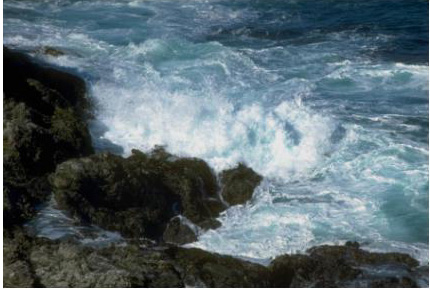
Home | Bhaitarkanika: Geographically Bhitarkanika is located between 20°4'-20°8N Latitudes and 86°45'-87°50' Longitudes. It is the second largest mangrove ecosystem of India, which has much significance with regard to ecological, geomorphologic and biological background that includes mangrove forests, rivers, creeks, estuaries, backwater, accreted land and mud flats. Bhitarkanika mangrove ecosystem flourishes in the deltaic region, formed by the rich alluvial deposits of Brahmani, Baitarani & the Dhamra River. About 145 km² have been notified as Bhitarkanika National Park vide Notification No.19686/F & E dated 16.9.1998 of Forests & Environment Department, Govt. of Orissa. Bhitarkanika National Park is the core area of Bhitarkanika Sanctuary, which was declared vide notification No.6958/FF AH Dtd. 22.04.1975 over an area of 650 square kilometers. The Sanctuary comprising mangrove forests, meandering rivers, innumerable criss-crossed tidal inundated creeks provide shelter to the endangered estuarine Crocodile (Crocodile porosus). Besides estuarine Crocodile, the Sanctuary is rich in other reptiles, birds and mammalian population. Theses mangrove forests are good habitat for King Cobra, Indian Python and Water Monitor Lizard. About 62 species of mangrove & its associates are found in Bhitarkanika Sanctuary. The dominant genera of mangroves and its associates include Acanthus, Achrostichum, Aegialitis, Aglaia, Avicennia, Excoecaria, Brownlowia, Bruguiera, Ceriops, Rhizophora, Heritiera, Hibiscus, Kandelia,Lumnizera, Phoenix, Sonneratia, Suaeda etc. Coastal Regulation Zone Information Systems : Bhaitarkanika: Orissa 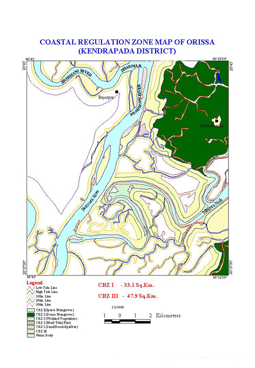 | |
|
Home | Introduction | CRZ | Study Area | Objectives & Methodology | Results | ||