| Coastal
Regulation Zone Information of Andhra Pradesh |
 |
| | ||
|
Introduction | ||
|
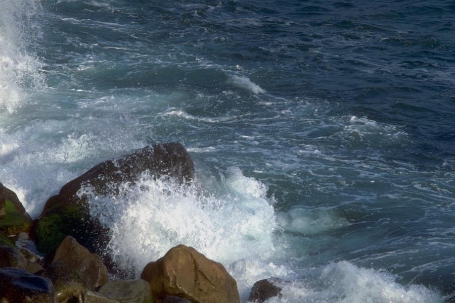
Home | Introduction: The coastal zone, the meeting place of land, sea and air, is a dynamic area with many cyclic and random processes owing to a variety of resources and habitats. Nearly three quarters of the world population live near or on the coast, as found to be true in India also, which has about 7,500 km of coast line with many sprawling and still growing coastal cities. The coastal zone is thus a place of hectic human activity, followed by intense urbanization, resulting in human interference because of rapid development. The coastal ecosystem is now highly disturbed and very much threatened, encounting problems like pollution, siltation, erosion, flooding, salt water intrusion, storm surges and ever expanding human settlements. The only way to combat these problems and to preserve the coastal zone for future generation is the concept of integrated coastal zone management which has been developed by many countries around the world. The need for such a programme in our country is most urgent and highly imperative. To conserve the coastal ecosystem, the then prime minister Mrs. Indira Gandhi suggested keeping the coast line free from all developmental activities within 500 m of the High Tidal line and made an announcement in the parliament and also advised the Coastal states to regulate development along the coast on 27th November1981(lr.No.762-PMD/81) Coastline of Andhra Pradesh: Andhra Pradesh lies between 12º 37' and 19º54' N latitudes and 76º 46' and 84º 46' E latitudes. The state can be classified in to three geographic zones (i) the coastal plain, (ii) the Eastern Ghats and (iii) the Deccan Pedi plain. The coastline of Andhra Pradesh is about 966 km and located in between 13º24'-19º 54' N Latitudes and 80º 02'-86º 46'E longitudes. The state has an area of 2,75,068 km² and a population of 53.55 million. The coastal zone is potentially a rich terrain from the point of view of agriculture, fisheries, commerce and communication. The coastline is smooth and long with inundations only in the extreme south and between Godavari and the Krishna delta. The sea is shallow off the coast. There are number of intermediate and small ports including a major harbour at Visakhapatnam Andhra Pradesh has 14 sanctuaries but does not have any National Parks even though this is the biggest of the four southern states. The delta of the two important rivers namely Godavari and Krishna are very fertile. They have the mangrove forest along the estuaries and dry deciduous forest inland. The state has one of the longest lagoons in south Asia, called the Pulicat Lake, having a variety of residents as well as migratory birds. Summers are hot and dry with temperature shooting up to 46ºC while winter temperature comes down 8-10º C. The major problems in Andhra coast are the erosion, storm surges and coastal pollution. | |
|
Home | Introduction | CRZ | Study Area | Objectives & Methodology | Results | ||