| Ecologically
Important Areas of Maharashtra Coast |  |
| | ||
|
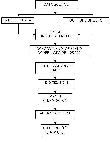
Methodology | ||
|
Home |
| |
|
Home | Introduction | Objectives | Methodology | EI Areas | Info in Detail | ||
|
| Ecologically
Important Areas of Maharashtra Coast | |
| | ||
|
Methodology | ||
|
Home |
| |
|
Home | Introduction | Objectives | Methodology | EI Areas | Info in Detail | ||